
The InTerAlp project (Jan-Nov 2024), funded by ESPON EGTC examined interface territories across the Alpine region. Alpine ‘interface territories’ are a highly relevant and interesting spatial category. By linking mountainous and inner-Alpine areas with pre-Alpine lowlands, they are a very specific territorial type: Highly dynamic flows and interdependencies as well as controversial stakeholder interests meet in a rather limited spatial framework. Organizing sustainable spatial development in this geographical context is a challenge. In order to provide a deeper analytical understanding and to produce policy-relevant results, the InTerAlp project focusses on questions and challenges related to the ‘interface territories’ of the Alpine region in a differentiated and rather complete way. The objective is to fill the research gaps and to promote sustainable development of the Alpine region.
The final results are now online:
- Final report
- Policy Brief
- Case study portfolio
- Spatial and sectoral governance in Alpine interface territories
Find the ESPON InTerAlp Case study portfolio storymap here.
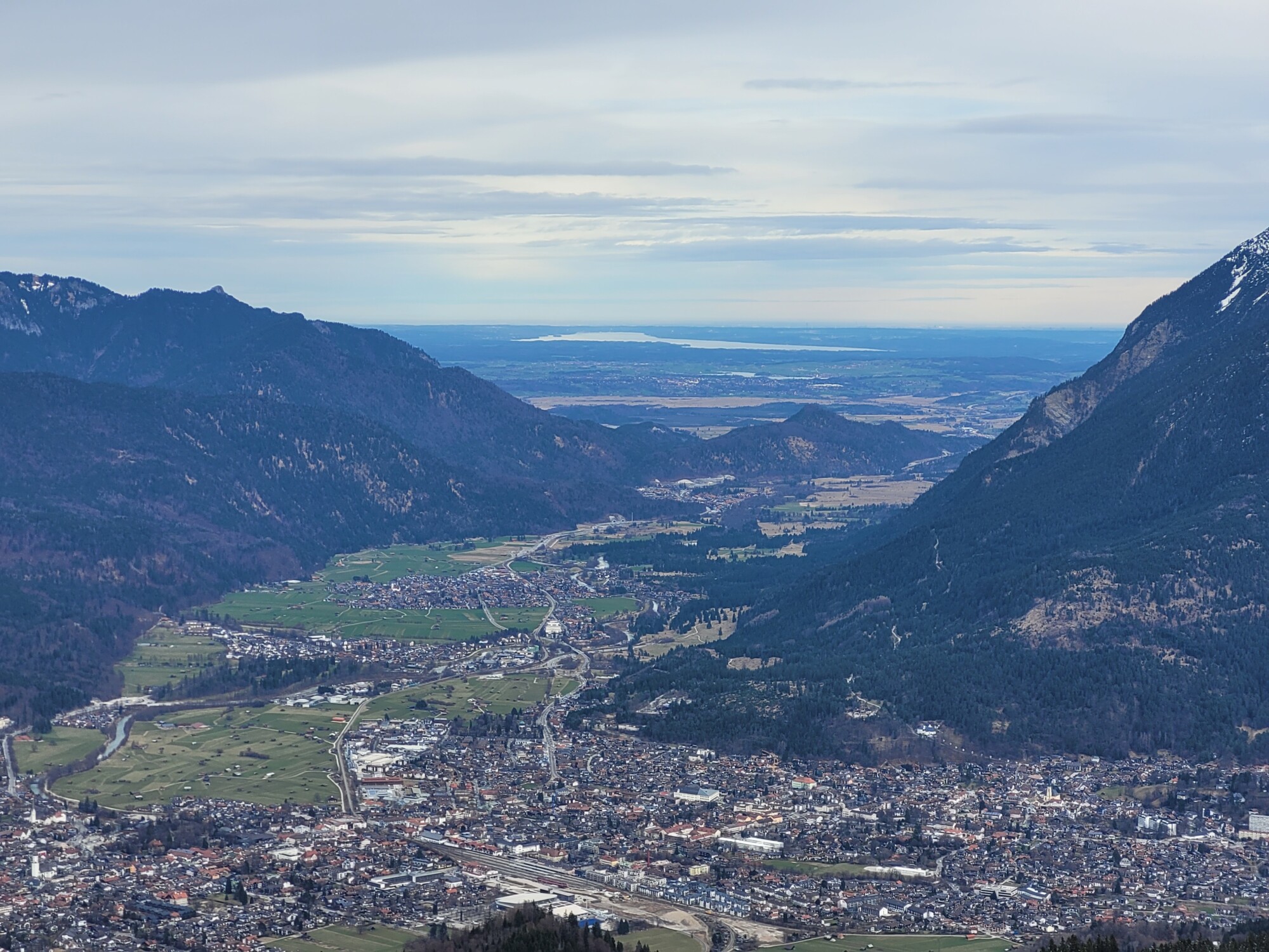
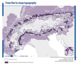
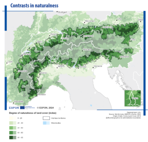
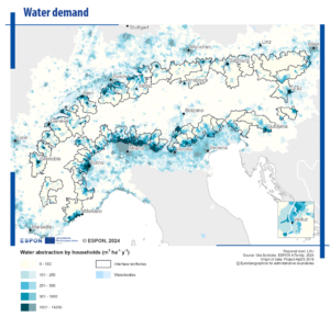
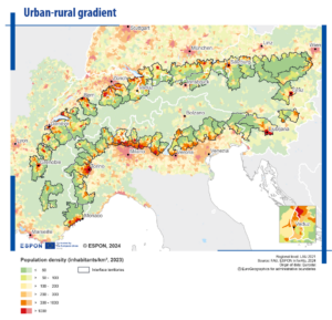
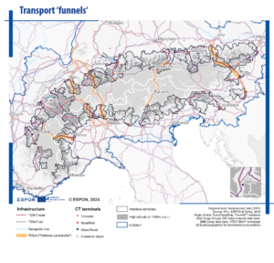
Mapping Alpine interface territories: A new geography?
To start the video, click the button.
Interface areas across the Alpine region – territorial contrasts as challenge and potential
See more maps and visuals in the final report.

Find more recent publications on Alpine spatial development here:
- Towards an Alpine Spatial Development Perspective – Synthesis Report: Compilation of three input papers
- Climate scenarios: linking climate change and spatial planning
- Assessment study: Cross-border spatial development in the Alpine Convention area
- Land take in the Alpine region: the data perspective
- 9th Report on the State of the Alps: Alpine Towns